ILSOYADVISOR POST
Current U.S. Drought Conditions for Illinois
To view current U.S. drought conditions, check out the Current U.S. Drought Monitor Conditions for Illinois.
The U.S. Drought Monitor (USDM) is updated each Thursday to show the location and intensity of drought across the country. The map shows drought conditions across Illinois using a five-category system, from Abnormally Dry (D0) conditions to Exceptional Drought (D4). The USDM is a joint effort of the National Drought Mitigation Center, USDA, and NOAA. Learn more.
The following state-specific drought impacts were compiled by the National Drought Mitigation Center. While these impacts are not exhaustive, they can help provide a clearer picture of drought in Illinois.
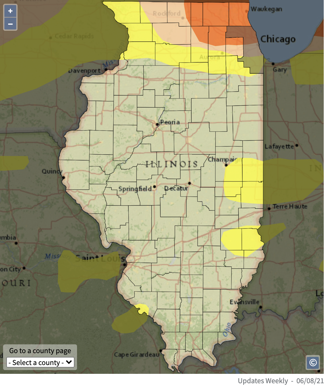
D0 - Abnormally Dry (20.9% of IL)
- Soil moisture declines
- Lawns turn brown
D1 - Moderate Drought (8.5% of IL)
- Row crops and pasture show drought stress
- Fireworks are banned
- Trees show drought stress; wildlife eat more crops
D2 - Severe Drought (4.6% of IL)
- Row crop and vegetable conditions are poor; hay yield is low; corn is baled for feed; agriculture industry is hurting
- Outdoor burn bans are implemented
- Water levels in wells, ponds, rivers, and lakes are low; streamflow is below average; voluntary water conservation is requested
D3 - Extreme Drought (0% of IL)
- Disease kills deer; fish are stressed
- Vegetation is stressed
- Well and reservoir levels are very low
D4 - Exceptional Drought (0% of IL)
- Feed prices are high; crop loss is widespread; livestock are culled
- Wildlife are severely stressed; fish kills occur in lakes and rivers
View drought conditions by county using the interactive USDM here.
Dr. Trent Ford - Illinois State Climatologist:
It would be nice if northern Illinois could catch a good rain soon. Below are two figures, the first is a plot of accumulated precipitation between March 1 and June 14 this year compared with past years in the Chicago area. The second is a map of total precipitation departure from normal across Illinois over the same time period.
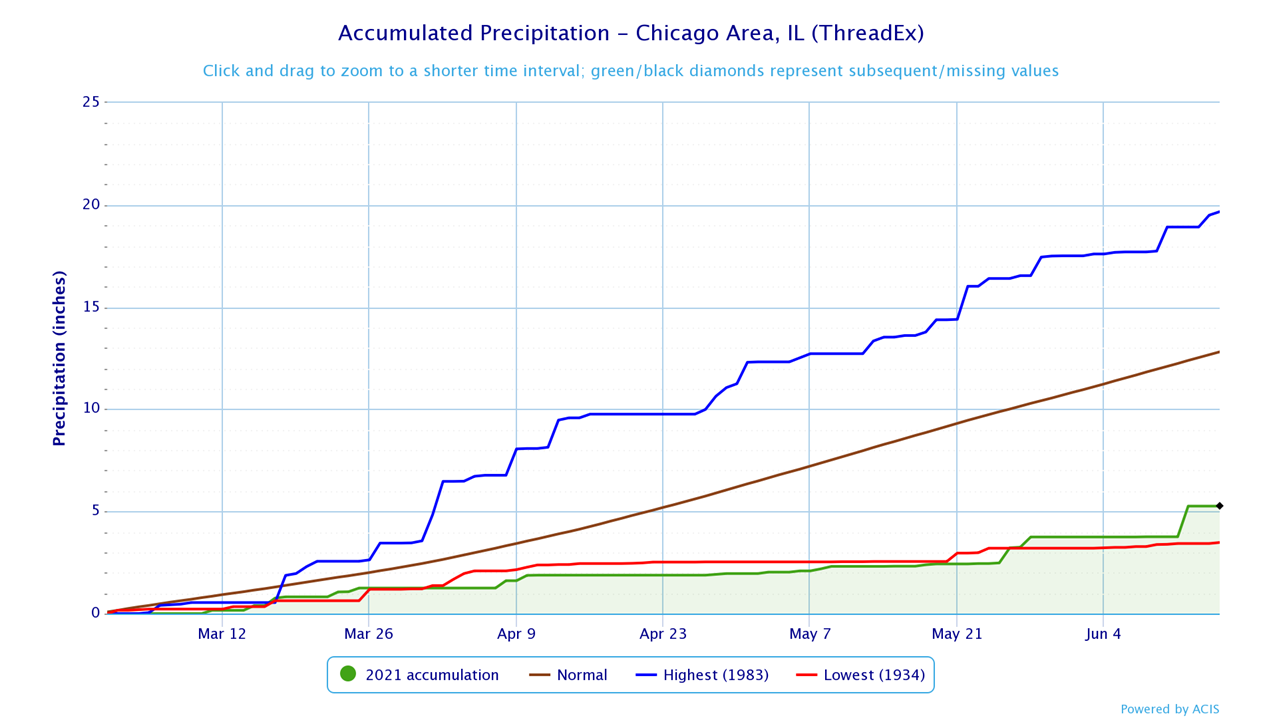
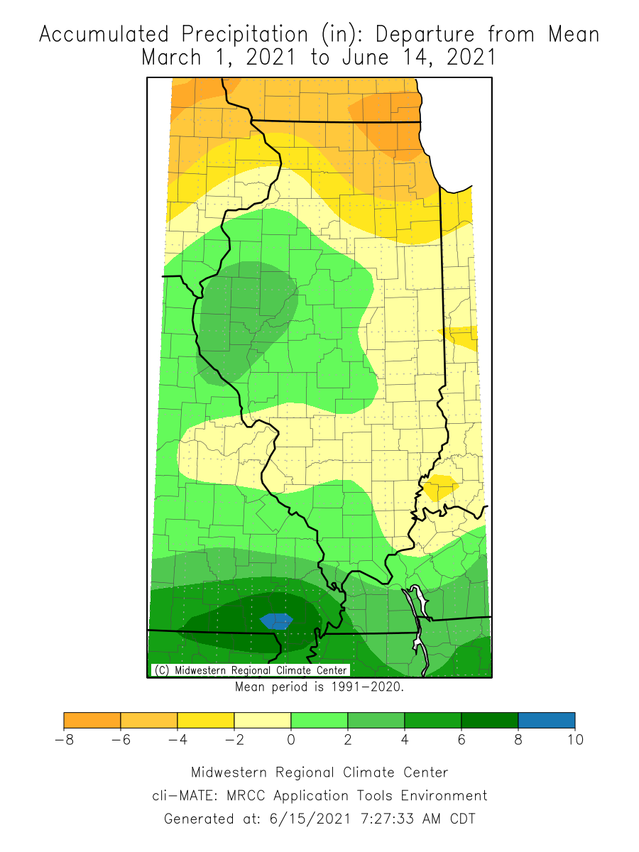
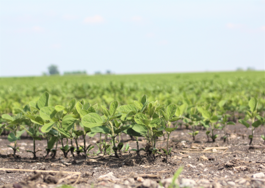
Northeast Illinois, particularly the area between northern Will County and the Wisconsin border, has been running a 6- to 8-inch precipitation deficit since March 1. More recently, the dryness has spread west, and most of northern Illinois is now suffering from moderate to severe drought. The dry start to spring was welcome at first, and helped early to on-time planting of both soybeans and corn. But the continued lack of rain following wrap up of planting has been problematic, and I'm starting to hear more widespread reports of signs of moisture stress, especially in later planted corn. Last weekend's heat was not helpful at all for already dry soils.
Looking ahead, National Weather Service forecasts are calling for more widespread 1- to 1.5-inch accumulations across northern Illinois this week, and models are indicating the latter half of June may be wetter than the first half. That's good news, and certainly a couple of wetter weeks will help limit further worsening of drought impacts. But, the dry spring and start to summer have left quite a soil moisture deficit, which will take several months to improve fully.
So, all that's to say that we're starting to see signs of drought impacts to crops. However, it's still early enough that a wetter pattern this month and into July would help stave off more significant impacts.


Comments
Add new comment